Monday, July 31, 2017

Day 27 Walk to Bocca Callalta

I left the hotel and walked through town. I crossed the River Piave on a large bridge. The first bridge in that area was built by the Romans. It has been important crossing throughout the centuries. I descended from the bridge to a "path".

The beginning of the hike was a bit rough. It was raining and slippery and the trail didn't look like a trail. It was overgrown but I perservered and soon it became more "trail" like. I walked along the river which was very pretty at that time of the day. At one point I was attacked by mosquitos but I fought back with insect repellent At one junction I saw a parade of four tractors. I wondered where they were going. (Later I believe that I saw them again )

Just after that I came to a large war memorial for WWI. It was called Osteria Al Glorioso Piave. This was the final battle of WWI. The British Gordon Highlanders were essential to the victory of this battle called Vittorio Veneto. A nice man walking asked me where I was going and wished me luck.


I walked by many crops. Grapes, corn, aparagus, tomatos and things that I could not identify. There were places to buy wine from the vineyards.


I had forgotten that today is Sunday so many places were closed. The grocery store in town was closed in a small village that I walked by. I found a little cafe but it seemed to mostly sell coffee. I had an ice cream.

I walked on. It was pretty hot. I saw a father and son buying water from a machine. Later I thought that would have been a good idea to buy some. I went by what looked like an old gun emplacement and bunker. Then I came to another village. Again the grocery store was closed. There was a little cafe. They didn't seem that interested in helping me. They didn't have the first thing that I asked for. I went out on the patio and thought it over and when I went back in. They completely ignored me. Despite the lack of options I left.

I walked on. I saw many tractors (at least 10) and other farm equipment parked by an old building. There was a marquee. I think the tractor parade that I saw earlier in the morning came here. It seemed like some type if farm club. There was some historic farmequipment there as well. At least I think it was historic. There was a group of people eating under the marquee. The field next to them looked like it had just been tilled so maybe they did that too

Soon I saw another one of those water machines. I was hot and decided to check it out. It dispensed water and soda water. There seemed to be a spot for coins and credit cards. The credit card slot didn't work. I figured that you need a special card. I had pulled out all my change when someone else came to buy water. He put his card in for me. It was so nice. He wouldn't take any money. I asked him if he had children. He said yes. I gave him a quarter. He said that he didn't want it but I told him that it was from the USA and it was for his children. I figure that all kids like money from other countries. He took it. I think that he told me that he has family in the US but I can't be sure.

Then I walked on to my final destination. I walked past the Museo Soldati Della Battaglia. It was closed but looked quite impressive. Per the book it is modernist Italian Facist architecture.

Soon I came to my hotel. For a moment I thought it was going to be repeat of yesterday but a very nice man stepped out and checked me in. The room was very pretty and cooled by AC.

I had a great spinach and zuchinni pizza for dinner. Tomorrow is going to be a long hot day. However, I am hoping to see some wildlife in the wetlands

Distance: 26km (16 miles)


Photos at https://www.icloud.com/sharedalbum/#B0q532ODWVPkrI
This is is my track for the last seven days
http://share.findmespot.com/shared/faces/viewspots.jsp?glId=0ZqguMWq0nIVvMudyEDQOcLFQgoN7hGXc

Sunday, July 30, 2017

Day 26 Walk through the vineyards to Ponte Della Priula

Trying to avoid the heat I started as early as possible. Initially I walked through the forest which seemed to be mosquito friendly. I pulled out the insect repellent that purchased earlier in the trip and gave myself a liberal coat. That helped keep those blood suckers at bay. Good thing I didn't chuck it to lighten the load. I haven't needed it for over two weeks.

I walked through many vineyards which were very picturesque. Then I came to an old mill powered by a water wheel (17th century). It was still in use until around 1950. It was then turned into a preserved historic site. In 2014 the area was hit by a flash flood at the same time that an event was being hosted at the old mill. Many people were injured and four died.


From there I walked on through a couple of towns. Then I arrived at Collato. Collato is the site of a 12th century castle. I was not able to enter the grounds because it is very unstable. It was bombed during WWI and largely destroyed. The tower remains standing and some of the wall around it. I stopped at a restaurant right next to it. The owner was very interesting. She told me all about the castle and showed me an image of what it looked like long ago. She told me that she had traveled to the US and it changed her life. After the trip she knew that she wanted to live outside of Italy. Since she couldn't get a green card, she moved to England and met her husband who is German. They have moved a bit and came to Callato two years ago. She also told me that I am the first American she has met doing the Munich to Venice hike. I don't think I am the first to do it but I may be the first to walk all the way to Venice. So many people bail out early because they are only interested in the mountains or it just gets too hot. (Yes it is pretty hot)

From there I walked on and on. I didn't see any other hikers but I did see many people on bikes and a couple of runners. Eventually I arrived at Colfosco. There I walked on a levee of the River Piave. This is the site of an important WWI battle. The AustoHungarians had the Italians on the run. The Italians dug in at the river and held the line. There were a couple more really big battles held at the river including the last battle of WWI after which Italy made huge territorial gains. There is supposed to be information along the river but I have yet to see it.

What I did see was a bee keeper at work. He (or she) was in full protective gear. The bees were smoked to calm them and then they hives were examined. That was pretty interesting.

I dragged my hot body and sore feet to the hotel. The door was locked and there was a sign saying the bar was closed. There was no information about the hotel. A very nice lady tried to help me but she seemed to want me to go up to someone's apartment. Luckily the gate was locked because I didn't feel comfortable doing that. Then I walked across the street to the Gelato place. They had also been watching me. They called the hotel. I ate a gelato. After I was done they hadn't any luck so we walked over because she wanted to bang on the door. She read the sign and called again. By this time someone else had come over. She called someone else and told me that they would come to the hotel. I was so impressed with how nice these people were. They didn't even speak English and were surprised that I wasn't German.

I eventually got checked in and told them that Lisbeth and her dad were coming. The really good news is that the room has air conditioning. Alls well that ends well.

To anyone who is considering doing this. I do have to say that today involved alot of road walking. It wasn't horrible but for some people it might not be the right thing.

There was some up and down today but it wasn't much and after today there will be little to no elevation change.

Distance: 29 km (18 miles)


Photos at https://www.icloud.com/sharedalbum/#B0q532ODWVPkrI
This is is my track for the last seven days
http://share.findmespot.com/shared/faces/viewspots.jsp?glId=0ZqguMWq0nIVvMudyEDQOcLFQgoN7hGXc

Saturday, July 29, 2017

Day 25 Descent to Tarzo

I woke early hoping to take a sunrise photo of the plains and the Adriatic and maybe even Venice. However the hut was shrouded in cloud so it didn't happen. I delayed a bit but it wasn't clearing anytime soon.
I walked down the road to a trail that traveled over very green hills and several mini summits. Along the way I met a man putting his cattle out to pasture. Even though I don't speak Italian and he didn't speak English we had somewhat of a conversation. I found put that all the land around was his. His dog's name was Lady. Two of his cattle (which were all white) had foot problems so they stayes in the barn. He also offerred me a cup of coffee which I thought was really nice.
From there I traveled over a few more green hills with old stone fences and then down to another refuge. It was supposed to have lots of war memorabilia but it didnt have much. It did have a huge crazy looking boar head. The day before I noticed up turned ground like an animal had been routing around in it. I am guessing that was done by wild pigs. The hut sold strudel for only 2.50 € and I had some. It had a big sign saying the water wasn't potable so I filtered some water. Sometimes I wonder if they put up those signs to make you buy water.
From there the trail traveled through forest for quite a ways. It dumped out just above the village of Revine. There was a really big church structure called a sanctuary there. It was built on the site of a former castle. Part of the church was used as an infirmiry for plague victims.

I walked through Revine which had many old stone buildings and the up a small hill opposite. I followed trails and road to Tarzo. I was on the lookout for my hotel but overshot it. Realizing my mistake I trudged back up to it sweating like crazy. I must not have looked that great when I walked in because the nice reception man gave me a soda water without even asking me anything.
The hotel http://albergoaipini.it/en/albergo/ntury i s quite old. In some places it says 17th and in others it says 18th century. It is very majestic and overlooks a vineyards. It is more expensive that what I have been spending but I think it is a good price for the type of hotel that it is. The people who work there are super nice as well. They let me put my washes clothes on their drying rack and are willing to put my breakfast out early for me. It was very hot today and I will be starting very early from now on to beat as much heat as possible.

Distance:18 km (11 miles)
Elevation up: 130m (400ft)
Elevation diwn 1670m (5500ft)

Photos at https://www.icloud.com/sharedalbum/#B0q532ODWVPkrI

This is is my track for the last seven days
http://share.findmespot.com/shared/faces/viewspots.jsp?glId=0ZqguMWq0nIVvMudyEDQOcLFQgoN7hGXc

Friday, July 28, 2017

Day 24 Final climb up to Rifugio Col Visentin

Mike and Vanessa left at 5:15am to catch a train to Florence. I got ip when theh left and hit the road at 5:45 after being releases from the hotel by the night receptionist. I walked down the the stairs to the river. As I descended I could see the escalator enclosed in plastic. It seemed to be closed. I prefer the stairs anyway.

I crossed the River Piave that I know I will be walking by on some future days. The I walked through some smaller villages, mountain roads and trails. The trail markkng was a bit scarce at times and I decided to walk a variant that wasn't part if the gpx track that I have. However, I was able to make my way without issue. Along the way there were some pretty river pools and I saw a couple gathering berrries

I returned to the main route and soon was in Nevega. I stopped in the grocery store (which didn't have cold diet coke) and bought a snack. The young woman who served me had many questions about the trail. I showed her my book and told her about life on the trail. When she picked up my pack, I think she was a little shocked.

From there I hiked through the ski area and beyond. The trail was good and even cool in some places. The last bit was a bit of a grunt but I had wonderful views of the Dolomites.


The rifugio had tons of communciations equipment around it. However it is made of stone and has a tower. It is kind if a contradiction. It is the last hut that I will stay at on this trip. From here on out it will be hotels as I make my way to Venice.

I bought Mike and Vanessa and myself Munich to Venice stickers. I had hoped for a shirt. The last hut had really cute shirts. However there are no shirts here. Probably best it would have just made my backpack heavier.

Dustance: 17km (10 miles)
Elevation up: 1600m (5000ft)
Elevation down: 270m ( 890ft)

Photos at https://www.icloud.com/sharedalbum/#B0q532ODWVPkrI


This is is my track for the last seven days
http://share.findmespot.com/shared/faces/viewspots.jsp?glId=0ZqguMWq0nIVvMudyEDQOcLFQgoN7hGXc

Day 23 Travel to Belluno

There were three choices of travel to Belluno. The first was a Via Ferrata route. That posed a few problems including lack of equipment, lack of experience and it was a descent not an ascent making it a more difficult first experience. The second was a trail that was not well marked and in 8 miles went up and then down more than 7000ft. That didn't seem to be a good solo option. The final choice was what I did.

It began with a slight ascent over a ridge and the. A big descent under the towering wallks of the Dolomites. The trail went past pretty waterfalls and gorges but it was bittersweet. I knew as I hjked down that this was the end of my alpine days.


From the bottom there was a bus to take us to Belluno. Vanessa and Mike and I shared a room. It was good to have a nice shower and we did alot of laundry. We visited the supermarket where I was lucky to find a cold diet coke. A question that we askes ourselves on the trail is "Why is diet come called coke light outside the US and Canada"? Inquiring minds would like to know

I had a chance to walk around the old town. I stumbled aross the old and huge door to the old town. There were many old buildings and churches which were interesting to look at. I couldn't find the eacalator that I was supposed to rake the next day but I did find a staircase that would take me down by the river where the trail starts

After I made my way back to the hotel (using Google Maps) we tried to pay our hotel bill. The recptionist said to pay later. She gave us a recommendation for dinnerr. I showed Vanessa and Mike where I had explores and then we went to dinner. At 7pm it was early jn Italy and we were the first people to arrive. We got a great table on the terrace overlooking the river. Dinner for Vanessa and I was an amazing pizza of zuchinni, feta and pesto.

By 8 I was ready to head back to the hotel to pay, pack and hit the sack. It was not to be. After much too and fro I was able to pay the receptionist my share of the room if I paid in cash. (The earlier receptionist said there would be no problem splitting the bill) There was also the problem of getting out. Apparently we were locked is so I had to give her the exact time that I would leave. In the end it was all settled.

Distance 10 km (6 miles)
Elevation up 150m (500ft)
Elevation down 1650m (5000ft)


Photos at https://www.icloud.com/sharedalbum/#B0q532ODWVPkrI


This is is my track for the last seven days
http://share.findmespot.com/shared/faces/viewspots.jsp?glId=0ZqguMWq0nIVvMudyEDQOcLFQgoN7hGXc

Wednesday, July 26, 2017

Day 22 Just beat the rain on the way to Rifugio Pian Fontana

I rose early. However there was already a line for the bathroom at 5:20. I waited patiently but one guy was pacing back and forth making more noise than necessary.

I went outside and took a pretty sunrise photo. Then I walked down to Passo Duran. There were some cute donkeys across the street. I had a little road walk from there. Some kindly gentleman thought I was going the wrong way and gave me advice but my phone told me that I was going the right way.

From there I climbed up and walked in a basin with fantastic views of the surrounding mountains. I could even see back to the Marmolada with its glaciers.

From there I hiked up to another pass where an old (early 1900) army barracks is located. It was surrounded by towering cliffs. I walked down to a rifugio. It was around 11:00 but they didn't seem very happy to see me. They grudgingly sold me an very small piece of apfel strudel and gave me a package if biscuits. I dried my socks a bit and went on my way. It was a grunt of a climb from there but exceedingly beautiful. There were just amazing mountains everywhere.


The other side was also beautiful. I sat at the pass for awhile and enjoyed the beauty. Then I started down. There were lots of marmots on the way down. They were pretty skittish and didn't want to sit still while I took their photo. Go figure!


There was a sign that the trail is very steep. I am not sure what they thought someone would do at that point. Turn around and go back? There wasn't another option.

It was a steep downhill but it has become par for the course.

There was an outhouse that is only a hole in the floor behind the hut. I went inside and got the bad new. They were full up. I had called the night before but I guess that I called the wrong hut.

It may be a night if emergency accomodation.

Distance: 20 km (12 miles)
Elevation up: 1200m ( 3900ft)
Elevation down: 1300m (4200ft)

Photos at https://www.icloud.com/sharedalbum/#B0q532ODWVPkrI

This is is my track for the last seven days
http://share.findmespot.com/shared/faces/viewspots.jsp?glId=0ZqguMWq0nIVvMudyEDQOcLFQgoN7hGXc

Tuesday, July 25, 2017

Day 21 Thunder and Lightening on the way to Rifugio Bruto Carestiato

A word about our room at Rifugio Tissi. There were five beds. However, if there were five beds and five backpacks, there would be no way to move around the room. Luckily it was just Vanessa, Mike and I. We still had a hard time moving around the room.

We woke to thunder, lightening and pouring rain. This was not entirely unexpected as we had been monitoring the weather forecasts. I dressed in rain pants and rain jacket.

Breakfast was a bit limited. There were bowls but no cereal or yogurt. The was a container of cocoa powder next to the bowls. Maybe people eat cocoa powder in bowls?

As luck would have it the weather cleared by the time we left. We had brilliant views of the Civetta group. We descended to Rifugio Vazzoler and then amended our clothing as it was warm and sunny outside.


From there is was a further descent. We almost missed it but Vanessa picked it uo saving us a costly mistake in time, distance and elevation. We walked through forest and scree under the wall of the Moiazza. Then we noticed the clouds rolling in and just like that the views were obliterated. Then we hears the thunder. We moved quickly over the Forcella Col dell'Orso pass. We stopped and put our rain jackets back on. We traversed the hillside and the storm moved in. Then we headed up and over another saddle called the Forcella del Camp. The lightening and thunder increased in intensity as we traversed the south flank of the Moiazza. We picked up the pace. It was pretty cloudy and we were walking in the clouds but I could make out the rifugio in the distance. We made it without incident.

We were pretty wet when we arrived. However a 1€ 2min shower felt amazing and they even have a dryer to dry our clothes.

Distance: 16km (10 miles)
Elevation up: 740m (2400ft)
Elevation down: 1160m (3800ft)

Photos at https://www.icloud.com/sharedalbum/#B0q532ODWVPkrI

This is is my track for the last seven days
http://share.findmespot.com/shared/faces/viewspots.jsp?glId=0ZqguMWq0nIVvMudyEDQOcLFQgoN7hGXc

Sunday, July 23, 2017

Day 20 Big up to Rifugio Tissi

Despite organizing an early breakfast, I thought that I would go without. We went to the hotel at 8:30ish last night to pay and get my breakfast but they basically told us to get lost and come back at 10pm. Since my plan was to wake at 5am that didn't work well for me. Also I knew that it wasn't going to be quick. It never seems to be quick at this hotel. I decided to give my share of the cost to Vanessa and Mike and not worry about breakfast. They said we could settle at the next hut and I went to bed.

As I left I found my breakfast hanging on the door. That was a good start to the day. I felt great going up the mountain. It was cool and I made good time it seems like in no time I was at Rifugio Coldai. Along the way I saw a large group of sheep and goats being herded by a shepard and dog. There were some very tiny lambs that kept getting left behind. The shepard would pick then up and give them a boost in the right direction. It was all very cute.

I had a quick snack and hiked over the pass to Coldai Lake. I took a ton of photos. Then I went over another pass and hiked below the towering vertical cliffs of the Civetta group.


Then there was one steep climb up to Rifugio Tissi which sits almost on top of a little peak. About 50 people were descending as I ascended. It was quite busy. Just after I arrived lots more people arrived. I figure that must be related to the start of the Gondola.

The hut is located just across from a vertical wall of the Civetta. However the room is the most cramped room that I have had.

I washed up in the sink and walked up to the peak behind the refuge. It has a beautiful view if both the Civetta and north to Lake Alleghe and the mountains I came from.

Distance:14km (8 miles)
Elevation up: 1760 m (5800ft)
Elevation down: 350m (1,150ft)


Photos at https://www.icloud.com/sharedalbum/#B0q532ODWVPkrI

This is is my track for the last seven days
http://share.findmespot.com/shared/faces/viewspots.jsp?glId=0ZqguMWq0nIVvMudyEDQOcLFQgoN7hGXc
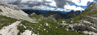
Day 19 Rest day in Alleghe

We had a nice breakfast and then I returned to the room to ensure that my GI problems from the previous evening weren't ongoing. I did a bit more laundry and then declared myself cured.

I decided to walk around the lake. It was beautiful with the mountains and clouds reflected in the lake. A number of white swans were swimming around the lake. There were tiny houses floating on the water for ducks.


I bumped into Vanessa and Mike playing dice by the side of the lake. We chatted a bit and then I continued around the lake to Masare.

In Masare I hiked up to a pretty little waterfall. One the way back I met a man gathering rasberries.

I wrote yesterday's blog under a tree next to the lake. It was relaxing.

I returned to the hotel where I renewed my teaching credential because I got a notification from both the California Teacher Commission and the school district telling me to do so.

I bumped into Lisbeth who will now be on the same track as me. She is also staying in the same hotel.

The weather is about to take a turn for the worse. There will be some rain tomorrow and more than an inch of rain the next day. I will be up on the mountain and I may take a rain day up there if it is too rainy. I hope that it is clear when I go by Lake Coldai tomorrow. It is supposed to be very pretty.

I hope that dinner tonight doesn't cause any more GI problems.

Distance:
Elevation up:
Elevation down:

Saturday, July 22, 2017

Day 18 Travel to Alleghe


I did not leave early. Instead I had breakfast with Vanessa and Mike and we walked to Alleghe together. The day began with beautiful views of the Marmolada and its glaciers. We walked along a brilliant green ridge towards Lake Fredaia and then began a steep descent to the village at the lake. We had hoped to visit the WWI museum but it didn't open until 10. We did see an interesting "chair" lift. This lift could carry two people up the mountain standing. It was pretty interesting.


From there we walked first on pavement and then down a ski slope. We were navigating pretty well until the path ran into a creek. We went down a grass slope. I was pretty sure we went past a sign that said no entry but I couldn't see another way to go. (In fact I think we were at that point on the track outlines in the book). Then a bunch if dogs went crazy barking at us an an Italian woman gave us a piece of her mind. We had no idea what she was saying but it didnt sound nice. I believe if we had stayed with the road there we would have been on the correct track. Instead flustered and wanting to leave the scene of our crime we headed towards a campground that was referenced in our book. That was slightly off course. However, the very nice campground manager told us which way to go and soon we arrived at the Sottoguda Gorge.

The Sottoguda Gorge has a toll for walkers. You can also take the train (truck driven). We decided to walk. The guidebook said the toll was 3.50€. However, the sign said it was 3€. That seemed great. The cashier told me to be sure and keep my ticket for the return trip. I told him there was no return trip because we were heading to Alleghe. Then he said that I am supposed to tell him that when I buy the ticket. Turns out the one way pedestrian toll is only 2€. Who knew?

The Sottoguda Gorge had tall moss covered walls and a stream running through it. The tempurature in it was very nice. We had a quick snack at a bench. One of the very interesting things in the gorge were tunnels dug by soldiers in WWI to store gun powder. These same tunnels were used in WWII as air raid shelters. They have also been extensively studied by biologists interested in molluscs.

We left to gorge and arrived in cute town of Sottoguda. The intersting thing about this town is that they have placed manniquins all over the town to demonstrate the traditional lifestyle. We also noticed that wood was not only neatly stacked it was decorated with designs in the stacks and flowers within the stacks.

From there we walked to Alleghe. It was supposed to be an "easy" day but we were tired when we arrived. However, it was great to go to the grocery store which had a coupke cold coke zeros. Then ran out after I drank them. There was also a place in the supermarket that sold wine by the liter. You could buy a container or they would fill your water bottle. We didn't buy any but I think that Vanessa and Mike will get some later.

We had a little happy hour on the balcony of our hotel - the Garni Eaperia. Then headed out to dinner. We decided on a pizza place. I got a pizza with zuchini and corn. It was yummy but my stomach wasn't so good later. On out bill was a cover charge. In the US we normally associate this with a club but this is a common practice in Italy as is closing shops for a couple of hours in the afternoon.

We are taking a rest day in Alleghe as we are a day ahead and we have been hiking for 18 days straight with significant elevation gain/ loss each day.

Distance: 24km( 14.88miles)
Elevation up: 230m (750ft)
Elevation down: 1670m (5500ft)

Photos at https://www.icloud.com/sharedalbum/#B0q532ODWVPkrI

This is is my track for the last seven days
http://share.findmespot.com/shared/faces/viewspots.jsp?glId=0ZqguMWq0nIVvMudyEDQOcLFQgoN7hGXc

Friday, July 21, 2017

Day 17 Lots of climbing ending at Rifugio Viel dal Pan

As usual I got an early start. It was great as I was the only one climbing up the Val Setus, a gash in the side of the Sella (the area of the Dolomites I am currently in). It was a steep scree climb and then a scramble up the rock face aided by fixed cables. The guide book describes it as an almost vertical rock face. I don't think it was quite that bad.

Once I had conquered that I walked past a hut situated above a pretty lake called Lago di Pisciadu. There to my disappointment a group if people hopped on the trail right in front of me. After taking lots of photos I soon passed them. I then realised that the climbing had just begun. I climbed up to the highest point on the Traumpfad- the Altipiano delle Meisules. It was a high plateau providing great views from where I came.


I took a break there to savor the moment and got back to it. I descended from
there and along the way saw some intricate rock designs that people had made. A short climb brought me to another hut. I stopped only to check my directions and then walked up to some type of stone marker. I traversed the edge of the mountain and walked by another hut (an lots of people). The most interesting thing about this hut was the outhouse put back that had great views.

I decided not to do the steep descent and instead walked up to the gondola. There were phenomenal views back and forward from the gondola. Back I could see the crazy landscape that I had walked over. Forward I could see the glacier covered Marmolada. The gondola trip down was fun.

The Marmolada is a volcanic moutain with the last surviving glaciers in the Dolomites. This area was the location of very intense fightinf during WWI. Artifacts from the war are being recovered as the glacier retreats due to global warming. The border between Austria and Italy used to run through the Marmolada. It was part of the frontline during the war. An under the ice s city with tunnels was built in the glaciers. More and more Italian seems to be spoken. I think that south of here I won't see or hear any more German

From the base of the gondola I walked up to a ridge that was opposite the Marmolada. I walked along that ridge that had incredible views of where I descended from which looked very far away, views of the north face of the Marmolada with its glaciers and views of the very pretty Lago di Fedaia.

Soom I arrived at my hut for the night. It has fantastic views. The name of the hut is Viel dal Pan. Google translate doesn't tell me what that means

Distance: 14.2 km
Elevation up: 1500 (5000ft)
Elevation down: 240m (800m)


Photos at https://www.icloud.com/sharedalbum/#B0q532ODWVPkrI

This is is my track for the last seven days
http://share.findmespot.com/shared/faces/viewspots.jsp?glId=0ZqguMWq0nIVvMudyEDQOcLFQgoN7hGXc

Thursday, July 20, 2017

Day 16 Climb a Chimney in the Dolomites

First a word in the "emergency accomodation" at the hut. They through mattresses on the floor and gave usb lankets. I thought that I had a pretty good spot in a little sitting room. However it was across from the bathroom. I was up most if the night with people going in and out. Two guys were in the hall. They were stepped on. Vanessa and Mike were at the end of the hall and fared pretty well. Finally Lisbeth was up stairs with a group of people. Apparently the room dwellers didnt appreciate that hikers hit the sack early and made lots of noise and mocked then for sleeping early.
Today I walked with Vanessa and Mike from Calgary. The day began with a traverse and then a steep ascent through scree. We saw a farmer milking a cow along the way.

Then a traverse over to the base of a rock chimney. We climbed up the chimney with the aid of fixed steel cables and a ladder. It was challenging but exhilarating.


From the top we walked over to the Puez hut. The landscape was described as a moonscape. While walking through a section of pinnacle like rocks, we (I) was asked to speak quietly. I guess I was being the typical loud american.
We saw some fun marmots, goats and sheeps on the way.
That is the days destination per our book. However, it was full and we didn't want the matress dilema again. We also still had plenty of energy. We walked three hours to a refugio that had plenty of space. The next couple days are short so we are considering combing them and having a rest day at Alleghe.
Distance: 18.8km ( 11.5 miles)
Unknown elevation:

Wednesday, July 19, 2017

Day 15 Into the Dolomites

My journey began by walking past the lager or dorm. Everyone else stayed in the dorm. There was a parade of cows going into the bottom floor of the dorm building to be milked. I am not sure that anyone was sleeping in today.
The trail was confusing at times today. I took a wrong turn but figured it out pretty quickly. The first part of the hike was along the top of a rounded mountain. The views all ways were fantastic.


I hiked up a small peak with a great 360 view of the mountains around. Then on undulating trail which passed a mountain chapel and a small lake (almost a puddle) with a big wooden boat in it to a hut that sits directly opposite the northernmost mountain in the Dolomite chain (Peitlerkofel). I had an orange soda there while I dried my socks and doctored a small blister. From there I headed steeply down into a valley and then back uo the other side. After a bit I came to the Wurzjoch where I fortified myself with an apfel studel
Then I walked down to the next trailhead. There I found a sign indicating that the Dolomites are a UNESCO world heritage site due to the uniqueness of the rock and ecology.

Things are now sometimes listed in three languages - Italian, German and Ladin. Ladin is an ancient Roman language.
There at the trailhead were some creepy statues. I am not sure what that was all about
From there it was an almost 1000 ft climb to the pass. It was afternoon by this point and pretty warm. I sweated my way up to the pass. There I was treated to incredible view if the surrounding mountains. Here the trail joins the the Famous Alta Via trail through the Dolomites

I took the last 30 min very slow. I was just amazed by the views. I eventually arrived at the hut. There I found some unwelcome news they were booked. However, they are going to give us emergency accomodation- mattresses on the floor. All of the Venice hikers seem to be in the same boat. I guess it will be a slumber party. It also turns out that all the next huts are booked.
Distance: 22km (14 miles)
Elevation up: 1370m(4500ft)
Elevation down: 990m (3200ft)
Photos at https://www.icloud.com/sharedalbum/#B0q532ODWVPkrI
This is is my track for the last seven days
http://share.findmespot.com/shared/faces/viewspots.jsp?glId=0ZqguMWq0nIVvMudyEDQOcLFQgoN7hGXc

Tuesday, July 18, 2017

Day 14 Transition from Zitteral Alps to the Dolomites

Today was not the most exciting day but it had to be done to get to the Dolomites. It began with a road walk and walks on tracks that paralleled the road. Most of the German walkers skipped this section by taking a bus. Frank left today via train to return home. Rudy will take two rest days in a nearby larger city which he will reach by walking and train. Volker will take one rest day because he booked all of his accomadation one day off.

In the early morning I saw a man driving a three wheeled truck (two back wheels and one front wheel). He was towing a big metal tin. I thought he was delivering milk and managed to point at it and say "latte" which I think is Italian for milk. He smiled and nodded and laughed when I took a picture. That was in Vallarga.

From there I walked to Niedervintl. I visited to grocery store there but sadly there was no cold diet coke or cliff bars. I did find some dried apricots. Google maps told me there was another shop but I wasnt able to find it. In fact a woman sent me back to the original store.

I left the town and walkes through some very tall corn and crossed a river. Then I hiked up through the forest. It was pretty steep in places. I had views of the Pfunders valley that I had walked down from on the other side of the river.

Up, up, up I walked. One the way I could see the logging in the area. I also walked through some green meadows. Finally I reached the Roner Hut. I took a small break there. They had a "dog bar" with bowls to fill for furry friends. Also an electric bike charging station.

From there I walked along a open high area with mountain views all around including the Peitlerkofel in the Dolomites which will be a target tomorrow.

The high areas are cultivated to grow hay. It was being harvested. First cut, then racked and then collected and rolled.

Finally I arrived at my destination for the night the Kreuzweisen Alm. It has been around since 1925. It is a working dairy that makes it own cheese. I am in a room not the dorm which is over the cow shed and reported to be smelly.

Distance: 24km
Elevation Up:1500m(almost 5000ft)
Elevation Down 800m (2600ft)

Photos at https://www.icloud.com/sharedalbum/#B0q532ODWVPkrI

This is is my track for the last seven days
http://share.findmespot.com/shared/faces/viewspots.jsp?glId=0ZqguMWq0nIVvMudyEDQOcLFQgoN7hGXc

Monday, July 17, 2017

Day 13 Travel to Pfunders

The weather finally cleared today. There were two large metal containers of milk outside the Gasthof. They must have been delivered in the night.

I hiked up to Gilderschartl Pass in clear, cool conditions. It was very beautiful. There were two amazing glaciers that were visible near the pass. From the pass I walked down to an amazing glacial lake called Grindlberger. It had clear water and was surround by the greenest grass or moss on one side.
I continued down a green grasssy valley. The views were amazing. I could see the Dolomites in the distance. I will be climbing them before this trip is over.
I came upon a small establishment called Obere Engbergalm. They were supposed to sell drinks but they didn't seem to have much besides beer and milk. The milk was in large metal containers sitting is cold running water to keep them cool. There were pigs and ducks onsite.
After an unsucesful attempt to get a drink I continued down and down. The water coming off the mountains cascaded over rocks in small and large waterfalls. The rain has made the middle mountains very green and lovely.
For awhike I walked on an old road that is only used as a hiking trail now. It was built right into the side of the mountain.
I am staying the night at Gasthof Brugger. I am happy to say that it has a great shower. The shower last night never got hot and had zero water pressure.
Distance: 20 km (12 miles)
Elevation up 1200m (almost 4000ft)
Elevation down 1550m (about 5000ft)
Photos at https://www.icloud.com/sharedalbum/#B0q532ODWVPkrI
This is is my track for the last seven days
http://share.findmespot.com/shared/faces/viewspots.jsp?glId=0ZqguMWq0nIVvMudyEDQOcLFQgoN7hGXc

Sunday, July 16, 2017

Day 11 Incredible Beauty on the way to Olpererhutte

The weather report was a bit grim- a high chance of rain. As I prepared to leave the weather was okay. There were high clouds but no rain. The views from the hutbwere very nice. I couldn't see anything last night.

From the hut there was a moderate descent. Along the way I saw a super cute black salamander. As I descended I noticed a cloud bank making its way up the valley. I have to say that I worried that this might mean an end ro the views for the day. I worried as I walked but I saw a couple if marmots on my way. The cloud seemed to come and go so my worries were for nought. I hiked up to Spannagelhaus and then the real work began.

The "trail" was mostly red paint on rocks. I was able to find my way without a problem. I needed to cross a couple of snow fields. They were generally flat and didn't worry me. One was a little steep but I crossed it without problem. It was hard not to be distracted by views of the glacier as I ascended.

The views north from the Freisenbergcharte Pass were great. I couldn't see anything south at that point i began the steep descent. There were numerous fixed cables to navigate. I got down but not in a graceful manner. I thought I was done and I took out my poles but there was yet one more fixed cable section. I was navigating it with my poles and I just finished when Volker came down the trail. We decided to visit the Freisenberghaus.

The guide book made it seem like it was a few minute walk to the hut but it was a steep boulder scramble and snow walk. However, the hut was very nice near it was a beautiful lake. Volker and I had a snack and enjoyed the atmosphere. It was freezing when we came out but the extremely steep uphill hike back to the trail nicey warmed me up. By the time we got there the clouds had cleared and had great views. I told Volker to go ahead and I took lots of photos. After a bit I decided to walk to the hut. As I walked a turquoise blue lake came into view with huge glaciated mountains behind it - undoubtly feeding the lake.

I dawdled a bit to long and it started pouring. Then there was a sheep jam on the trail. I thought they were being sheparded by a figure in front if them but she crossed the suspension bridge and left then behind.

After I crossed the suspension bridge I arrived at the Olpererhutte. I like this hut very much. They are nice and the shower is hot

Distance 14km ( 9miles)
Elevation up 1400m ( 4620ft)
Elevation down 800m (2640ft)


Photos at https://www.icloud.com/sharedalbum/#B0q532ODWVPkrI

This is is my track for the last seven days
http://share.findmespot.com/shared/faces/viewspots.jsp?glId=0ZqguMWq0nIVvMudyEDQOcLFQgoN7hGXc

Day 12 Give it five min and the weather will change - travel to Stein

As I left the hut I noticed that there was fresh snow on the surrounding mountains. It was pretty chilly and began to snow. I warmed as I hiked uphill. The path is called the Panorama Hohenweg. It has large cairns and at various points it is constructed of large slabs of rock. As I walked the views alternated between being obscured and then showing glimpses of towering glacier covered mountains across the valley. I walked through an amazing bowl with tarns and a small lake.

I continued to a pass called Pfitscher Joch. There I crossed into Italy. There was a guy whistling a song from the Sound of Music. I said "Hey the Sound of Music". He said yes and laughed. Then he asked me if the weather was any better in Italy as he was still in Austria. I told him it was. There was a pretty lake at the pass and a hut.

This area is called the South Tirol. It used to be part of Austria until WW I. In this area both German and Italian are spoken. There has been political unrest. The hut needed tonbe rebuilt after it was destroyed by a bomb during the unrest.

At the hut they had a big heart with ribbons. Inside the hut they give you two ribbons. You tie one on the heart and the other your wrist (I put it on my back pack)

I had a break at the hut with Rudy, Frank, and Volker. I left before them. The last 1.5 hours was down into the valley. There were huge mountains with hanging glaciers to the south east. I wanted to walk towards then but another storm approached. I walked down through the forest and fields to a small village called Stein. I am staying at the Gasthof Stein. The village seems to include only farms other than thus Gasthof and the one next door.

I saw three men wearinf the traditional Tirol hats. I askes them if would be okay to take a photo of them. They said okay.

I am not sure about dinner tonight the menu is literally hard to read. I did notice that they have omlettes but they are listed under dessert. I can't seem to get a clear answer on this but an omlette sounds good

Even though I am in my third country my guide tells me that I am not yet half way to Venice.

Today was a pretty wasy day. Tomorow will be another big day.

Distance: 13km
Elevation up: 400m(1320ft)
Elevation down: 1310m (4323ft)

Photos at https://www.icloud.com/sharedalbum/#B0q532ODWVPkrI
This is is my track for the last seven days
http://share.findmespot.com/shared/faces/viewspots.jsp?glId=0ZqguMWq0nIVvMudyEDQOcLFQgoN7hGXc

Friday, July 14, 2017

Day 10 Rainy Hike to Tuxer Joch Haus

I was glad to have wet weather gear today. It rained on and off all day. I began walking and soon realized that my location did not match the gpx track. I walked back and asked a fellow on the trail. I dont think he understood what I was asking or just dodnt know the answer. I continued walking back and bumped into Rudy. He was following a different track. I went with him. It was a slighly differnet track than I had but it got us where we needed to be. The trail was muddy and slippery but we made the first pass - Geierjoch. There were unfortunately no views. We could barely see Junssee Lake. From there we descended and then ascended a scree field. Unfortunately we got off the trail a bit. It was a bit sketchy being off trail in slippery muddy scree. However me managed to scramble back up to the trail and eventually reached the second pass of the day. It was called Gschutzspizsattel. Unfortunately there were no views there either. We walkes down a muddy and slippery slope into the Weitental Valley. With that we left the Tux alps and entered the Zillertal alps. There were apparently many waterfalls surrounding us but we didnt see any until we reached a huge one at the valley bottom. It was really pretty. We were taking photos of it when about 25 people showed up. It must have been some type of tour. I realized at this point that my spot tracker hadnt been turned on all day

Then it was uphill again to to another pass and our hut. We decided to take the road as the trails were very wet and our shoes squishy with water

I wasn't at the hut 15 min when Volker and Frank showed up. They had lost their way and took the ski lift up.

The hut has some type of shoe/boot warming system that I hope dries my shoes before tomorrow. I am not sure what I will do tomorrow. Its a big day but the weather doesn't look great.

Distance 12 km
Elevation up 1140 m. (3700ft)
Elevation down 870m (2800 ft)


Photos at https://www.icloud.com/sharedalbum/#B0q532ODWVPkrI

This is is my track for the last seven days
http://share.findmespot.com/shared/faces/viewspots.jsp?glId=0ZqguMWq0nIVvMudyEDQOcLFQgoN7hGXc

Day 9 Hike to Lizumer Hut

Today's hike was along an incredible ridge in the Tux Mountains. We summited six peaks on a variety of trail types. At times we were scrambling over boulders. At other times it was normal trail. Then there were several cable assisted areas. The views were phenomenal. I walked with Frank, Volker and Lisbeth to make sure that we all made if safely over the crest. I saw another marmot today. There doesn't seem to be as much wildlife here compares to the US
After the six peaks we weren't done. We hiked through a military training area to the hut. There seemed to be quite a bit of helicopeter activity. There was also some type of troup training exercise
The people running the Luzimer hut were pretty funny. They kept joking about the hot tub in the rooms. I washed my clothes and put them on the clothes line. Of course it then started pouring. Luckily they had a heated drying room and my clothes did dry by the next day. Just before dinner they sais go outside and see the pigs. By the time I got there they were gone. One of the hut workers said something like "soon they will be speck (bacon)"
Dinner was good- more spinat nudel. I hit the sack early. Feeling tired.
Distance 15km (9 miles)
Elevation up 750m. (2475ft)
Rlevation down 1330m. (4400ft)

Photos at https://www.icloud.com/sharedalbum/#B0q532ODWVPkrI

Wednesday, July 12, 2017

Day 8 Up to Glungezer Hut

There were a few options for today. I could have walked all the way to the hut. That would have been 2400 m (almost 8000ft) elevation gain. I could have taken the bus to the chair lift and then the chair lift. That would have been 575 m (just under 2000 ft) elevation gain. What I did was about 960m( 3000ft) elevation gain. I walked from Hall up to the chair lift. Then took the chair lift and walked up from there.

I left Hall via the castle. I turns out that in 1486 a coin was minted there that was "coined" the first dollar. Forgive the pun.

From there I walked in a variety of trails and roads to to Tulfies. Along the way I met a woman who spoke no English. She was picking rasberries along the trail. She tried to tell ne something about the birds or flying but I have no idea what she said.

I saw a deer along the trail and some adorable sheep. There trails were quite confusing but I ended up in the right place. The gpx file and gaia are invaluble on this hike because when out of the mountains themselves the signage is poor or non-existent.

From Tulfies I took a chairlift up. It was actually two lifts. I got off the normal chair lift and on a one person chair lift. Well I was hesitant to get on. It was an odd looking contraption and I had to manage my large pack. I tried to motion to the attendant that I wanted to wait and watch someone else. However he shut the whole lift down and loaded me on. It didn't go smoothly so maybe that was the best thing. My poles kind of got in the way of the guard bar. I held my pack tightly all the way up. I was able to get off at the top without dropping my pack or tripping over myself.

The view from there was awesome. I could see the mountains that I hiked over and down yesterday. They were shrouded in cloud. It was so beautiful.

I stopped off to continue my apfel strudel tour. It was actually chilly. The waitress asked me where I am from and when I told her she said its cold here. I replied no its nice. I have been walking from Munich and it has been very hot. They were impressed that I am doing the Munich Venice walk and showed me the way to the path.

I wasn't walking long when I noticed Volker in front of me. He had taken the bus and chair lift and must have pased me while I was strudeling.

We walked up to the hut together. I had my first Austrian marmot sighting. Along the way we compared health care in the US and Germany. It is interesting that both countries are struggling with this topic.

We followed a trail and thought we were lost. We didnt see the hut. Then we had to laugh at ourselves as we were standing right next to it. There were bright prayer flags flying next to the hut.

We checked in with a lady and her child from Poland. The host is a jolly soul. He had alot to say about our president and none of it good. That seems to be the general consensus over here. No one seems to hold it against me personally. After checking in he gave us shots of pflaumen (plum) schnaps. Schnaps is a specialty of the region. He wouldnt take no for an answer. It burned going down. Maybe this was punishment for the US presidential choice. How many years ago was it that I drank cold peppermint schnaps? Feels like a lifetime.

The hut hires cooks from Nepal. I spoke to the cook who is from the Everest region. He is here for four months to cook. I asked him if we would have dal baht but sadly no only lentil soup. There was some sherpa soup with momos but they are beef momos. I had lentil soup which seems like the first healthy thing that I have eaten in ages. It came with bread made right here on the mountain. It was delicious. The bread came with Schmalz(lard with bacon?) I didn't touch that.

Later I went for a walk and I saw a Materialseilbahn (material lift) bringing thing up to the hut much like a chair lift for supplies.

I walked up to a nearby peak and it started raining. I came back for my rain jacket but when I went back outside it was pouring so i decided to write my blog instead.

They are playing great music in the hut. All American classics
Photos at https://www.icloud.com/sharedalbum/#B0q532ODWVPkrI

Tuesday, July 11, 2017

Day 7 Down to Hall

Today began with an invigorating hike straight up to a pass where I had my last views of Karwendal NP. Pretty views both ways from the saddle and then down, down, down through an amazing meadow where I saw a larger mammal- maybe a chamois bounding into the trees. The meadows was lush and wet from last nights rain.

I did a quick stop at an old monestary. It is now a place to grab a quick bite to eat but it was closed today.

Below that I walked by an old salt mine. They seem to remove the salt from the rock with water and then pipe the brine down and check purification levels at stations along the way. I am not sure if the mine is still operational but there has been salt mining in that location for over 2600 years.

Friom there I hiked into the historic town of Hall. On the way a kindly gentleman in a car offered me a ride because Hall is "2 km away". Little did he know that I had walked all the way from Munich. What is 2km after that?

Hall is very pretty with lots of old world charm. I ended up getting an apartment for the night. It only cost €54. Since a cheap hotel room costs €49, I consider that a great bargain.

I was able to do a couple of necessary things- like get a new usb charger since I lost the european power attachment for the one I brought with me. I also bought some dried apricots. The diet of kasenspatzle and spinatknudel doesn't seem to have my normal fiber content wreaking havoc on my bodily functions. Also to my utter glee I found some cliff bars and diet coke at the grocery store.

I had dinner with one of my hiking buddies and turns out we are heading in the same direction. (There are a number of variants at this point and a number of people that I had been hiking with split off to do the other variant ) There is another challenging piece of hiking coming up in two days and we are going to tackle it together for safety.

Distance 14 km
Elevation 240 (800ft) m up / 1450 m (4700ft) down

Photos at https://www.icloud.com/sharedalbum/#B0q532ODWVPkrI

Monday, July 10, 2017

Day 6 What a Challenge Travel to Hallerangerhaus

The weather report last night was a bit of everything- sun, rain, hail, thunder, lightening. I went to be not sure of what I would do in the morning. Fellow hikers Volker, Rudy, Marlis, Helmut and I decided to meet in the morning and discuss the options. The day dawned sunny so we decided to go for it.
First up we climbed through the avalanche barriers aided by steel cables where necessary. After that heart pounding start it was a steady climb up for two hours. The last part was pretty steep. Volker and I stuck together through the climb to watch each others backs. It was pretty spectacular. We finally got to the saddle but just took time to take a few photos. We both were aware of dark clouds to the west. The next part of the hike was the most challenging part for me. It was super steep downhill. First over loose rock for 50m. Then over solid rock. We down climbed the rock with the support of steel cables. My nerve and feat level was very high during this section. Volker was super patient and coached me when I got a little stuck. I could probably have done it in my own but it was very comforting to have someone there. After that there was a steep scree field to descend. The other three were able to do this much more quickly than I. I told them to go ahead. I caught up with them later at a beautiful pool of water coming off the mountain. They were cooling off in the pool. We had a snack. I thanked Volker and gave him some chocolate. The others filled their water bottles here. I guess they don't worry about water diseases because they didn't filter
From there there was yet more downhill. I thought I had left the cables behind me for the day but there were more including one that went across a smooth boulder with no footholds. Metal spikes were drilled into the rock so I was holding my poles, holding the cable and balancing on the spikes and hoping for the best.
Finally we arrived at a small farm house called Kastenalm. We bought a few snacks. Most people bought fresh milk as this farm has five milk cows. They also have 50 other cattle. I had an orange soda as diet coke and diet sprite are not stocked in the mountains.
After topping off my water I set out for the last two hours of the hike. It was another 500m uphill and pretty warm but I did it fairly quickly and arrived before the others.
There was a little misunderstanding with my reservation. Apparently Karwendalhaus booked it for one day early the day that I stayed at Karwendalhaus which makes no sense. Hallerangerhaus was very nice about it. I ended up getting a room with only four beds. It is fantastic. I also got a shower which was fantastic. Between sliding over rocks and sweating like crazy I was so ready for a shower especially because I didn't have one yesterday.
Oh no i just attemptedto charge my electronics and I realized the adapeter is missing for my usb charger. Not a total disaster as I do have a back up power supply. However I will need to locate a replacement. Luckily I am heading to a town tomorrow i am sure that I will be able to find something.
Distance 15 km
Elevation up 1550m down 1560m
Photos at https://www.icloud.com/sharedalbum/#B0q532ODWVPkrI


Day 5 Travel to Karwendalhaus

The night was filled with thunder and lightening so I didnt know what the morning would bring. It brought more rain but only a little thunder and lightening. I debated a later start but thats why I carry rain pants and an expensive rain jacket. I put then both on and stepped out. I decided the rain pants were over the top and took them iff before I ever started out. I used the raincoat on and off all morning. The rain alternated between light to steady to heavy at timea.
The first part if the day was unimpressive hiking along a rather busy road as cars filled with mountain bikers speed by. Crossing the river a couple of times was impressive. The river is a beautiful color and cut into the earth creating an impressive gorge. I crossed the border into Austria in this part of today's hike.
I stopped in at Hinterriss for a quick break and some strudel. Maybe instead of calling this trip the Dream Way it could be called the Apfel kuchen/strudel way. Anyway it was delicious. I highly recommend it. Then I discovered a bonus. There was wifi. The guesthouse didn't allow us to use their wifi last night. I posted yestedays blog. Then I looked out the window and I saw several chamois munching on the green grass next to the gasthof. It was like the elk who gather at Yellowstone to enjoy the lawns in the people populated areas.
From there I headed out up a trail. There was a mountain biker in the trail ahead of me. Initially it was a wide track but it evolved into a single track that crossed a creek, had several downed trees and was severely eroded with a major drop off next to the erosion. At some point I caught uo to the poor mountain biker who decided this trail was not for her.
I continued climbing on trails that at time were sharef with mountain bikers and at times diverged into activity specific trails. One poor guy asked me for directions. He must have been hard up. I think I sent him the rigjt way.
Right around there I caught up with a guy who stayed in the lager (dormitory) that I was in last night. This kind of confused me because I knew I was the first one to leave. Although he could have passed me on the strudel break. However, as soon as he saw me he let me know he took the bus to Hinterriss and that is how he got ahead of me.
We leap frogged in the trail on and off up to Karwendalhaus. The trail became beautiful. It opened into a bowl just below the jagged limestone cliffs called Karwendal. There were great meadows with grass, wild flowers and cows below the cliffs. This is what I am here for. I love the alpine environment.
I crossed over the pass and down to the hut called Karwendalhaus. It is built right into the cliff and is amazing. I feel very fortunate to be able to stay here.
Volker and I arrived at the same time. After a snack he helped me check in. There is an unusual color coating system here. I was told go up to the third floor. Find the bed with the blue line. Two are already taken. You take the third. I thought this put a crimp in my choose the best bed system but I ened up with the exact bed that I wanted- on the end and next to the window. Volker ended up with one across the way. As we unpacked I learned he is from the Berlin area. In fact he is from the old East Berlin and had lived there before the wall came down. We had a interesting conversation about that.
. Then I decided to take a shower. The joke was on me there is only cold water. I did wash my clothes. Oh the joke was one me again it started pouring outside when I went to hang them. It was only a brief shower and soon I was able to hang them out. It was so windy I had to take then down. I was worried they fly away forever. I saw one guy looking over the edge of the balcony like he lad lost something. It a long way down
Outside the hut there is a red circle with a cell phone painted on it where thwre is apparently cell phone service. My poor phone had no service.
Tomorrow I am going up and over those jagged peaks. It is supposed to be steep both ways with steel cables to assist. It is not recommended if there is bad weather. There is a weather and trail info meeting tonight at 7:30 which I will attend to ensure that it is safe to go.

Photos at https://www.icloud.com/sharedalbum/#B0q532ODWVPkrI

Saturday, July 8, 2017

Day 4 Travel to Vorderiss

I got an early start as usual. I had purchased a cheeseplate fior breakfast and they put it in the fridge for me overnight. I made a cheese sandwich for breakfast and took the rest with me to eat in the road. The day started with an uphill climb out of the valley back to the ridge. From there I soon descended down, down, down. Towards the bottom there were some beautiful cascades and water falls.

Along the way I was attacked on and off by black biting flies. When I walked into Jachenau, I was initially disapppinted as the gasthof was closed but the owner told me I could go to the shop. I didnt know there was in there. I bought some pretzels and a coke light. I also wanted to get some bug spray. I couldn't find it but I did find some Raid. I took it up to the counter and pretended to spray it on my arm. The lady was appalled and said "no no". I think she thought that I thought that was personal bug spray. I just meant where is the right kind. Well she did show me the right kind. For 8 € I was the proud owner of bug spray. I debated if this was a good thing making my pack heavier. However in the next section of the hike the bugs attacked me with a vengence. I stopped to put spray on and it got worse until I throughly covered myself. These bugs are vicious. Some of then drew blood. Luckily they aren't itchy just painful.

The hike down the hillside to Vorderiss was very dramatic. The River Isar was a brillant blue and it was surrounded by a massive gravel bed

I am not sure what tomorrow will bring. The next step is Karwendalhaus but I don't have a reservation. Vorderriss said I could stay a second night. However Marliss just arrived and said that she has a reservation for me at Karwendalhaus which would be awesome

Vorderriss is my last stop in Germany. I cross the border to Austria when I leave here

The distance today was 18km (approx 11 miles) 710m up and 1279m down. I cant seem to open the Internet to do the calculations to miles and feet.

I still dont have the images thing sorted out but you can see them all at

https://www.icloud.com/sharedalbum/#B0q532ODWVPkrI

Friday, July 7, 2017

Day 3 Travel to Tutzinger Hutte

I left Bad Tolz as it was just awakening at 6:15am. The first part of the hike was pretty flat along the River Isar to Lenggries. That was about 6 miles almost half the day's total distance but it didnt include any of the 4000ft elevation gain. I knew it was going to be a bit if a shock to the system when I started climbing. To prep my system I treated myself to not one but two cherry cinnamon rolls from the supermarket bakery.
Then I waddled up to the ski hill and began a steep and very warm climb to the top. It wasn't too bad. Of course, I was red and sweaty at the top compared to the mountain visitors who chose to ride the cable car up. After a brief stop where I checked out the paragliders jumping off the sheer cliff, I began a ridge walk. Despite it bring described as a steep and exposed, I didn't find it too bad. There was one ladder and a few sections of fixed cable. There were also numerous places were I used my hands to climb up or down. I went slow but didn't feel overly worried about the conditions. I "bagged" three peaks along the way. I also startled a poor grouse chick which was in the trail. It's mama freaked out and I thought she was going to dive bomb me or something. I met a sweet Irish family day hiking along the ridge. The kids were having a great time with it. I think the Dad was a bit worried about me hiking on my own.
At the hut there were alot of people hanging out. I don't think most if them are staying the night. I have a nice bed in a room that holds six. I will time to see if the loud snoring German in tiny underwear holds up as most the room inhabitants are German males.
It was so good to take a shower I was soaking wet with sweat when I arrived. I met a lady named Marlies who is at least hiking a bit of what I am hiking.
I wanted to stay flexible so I hadnt booked too far out and now that has bitten me in the butt. I cant stay where I wanted to stay on Saturday. I did get a reservation there on Sunday. Not sure what I will do about Sat night yet. So I am already a day behind.
Today's statistics were 13 miles 4000ft elevation gain

Still not able to add images but you can see them at

https://www.icloud.com/sharedalbum/#B0q532ODWVPkrI

Thursday, July 6, 2017

Image Issues

The app that I was using to write my blog has decided to no longer work.  I can't seem to add images easily using blogger on Safari. If you know of a good app to use to write in blogger please let me know. I was using Blogo but it keeps giving me an error

Day 2 Travels to Bad Tolz


I left Wolf Town walking first over streets and then along a canal. This spit me out on a cycle trail and then on to a suburban street. I knew that I needed to turn into the forest and when I saw a bunch of parked cars I figures that I had the right place but no trailhead was obvious. Looking up I realized that a woman was talking to me and gesturing back up the road. I walked back the way I came but still saw no trail. She kept indicating into the forest. I think I missed her trail but I found another. Walking through I saw remants of WWII (or Cold War?) like the one shown below
The trail wove through the forest and along the river branching unmarked many times. I have no idea how I would have navigated it with Gaia (thanks Leah Carter) and the gpx file.
There were lots of flowers and butterflies along the way. The river was very pretty. Eventually I got to a place where I couldn't figure out where to go. I went straight. That didnt seem right. I went left. That didnt seem right. I returned and went straight again. Looking at the trail on Gaia I realized that I was a bit off. I walked in the direction that I knew the trail should be. I saw a trail marker and followed it. It took me to one of the most indistinct trails that I have ever been on. Then it dumped me into a farmers field. Thinking that I was in private land and needed to return to the forest I walked up and down but could not pick up a trail. There was a very nice lady doing something with a tractor in the field. She came over and gave me directions. I needed to walk up to the farm houses and walk between them over the electric wire. Sure enough that worked. If I had read the book I would have picked that up.

The next section was pretty straight forward and then I got to another section where I walked one way, decided it was wrong, went back walked another way, decided it was wrong and then walked back and went the original way which went to where I needed to go. I think I was actually supposed to go through the agricultural field but I got to the location that I needed. After a bit more walking I was back at the river which was dammed into a lake. It was a short and pretty walk along it to Bad Tolz.
I arrived hot and tired. I think that I hiked about 19 miles. Below is a statue that I saw alongthe way that reflects how I felt at the end.

I checked into my hotel, showered,washed my sweaty clothes, ate a cherry kuchen and put my feet in the river to cool off. Tomorrow is a big climbing day but fewer miles.

You can see more photos at https://www.icloud.com/sharedalbum/#B0q532ODWVPkrI

Wednesday, July 5, 2017

Day 1 Naked Hiking Munich to Wolfratshausen

I was up early to beat the heat and I hit the trail to Wolfratshausen. The initial stages of the hiking was along the River Isar and then along it canals. I shared the trail with many runners, walkers and cyclists (all clothed) near the city but that thinned out as I moved farther and farther from Munich. I initially crossed a couple of bridges that had a variety of engraved padlocks. These are put there by lovers. My question is what happens when they break up? Lock cutters? Do they stay there? This practice has been modeled on the famous Pont des Arts in Paris

I planned to stop in Pullach for a snack and took a "wrong" turn that had me climb up a very steep set of stairs. Once up there I realized that where I had been headed was actually below on the river. The delay certainly didnt matter because when I got there it was still closed and not opening for hours. I sat in the garden, filled my water bottle and ate a cliff bar anyway. I think I was about a third of the way to Wolf town.

I walked through forest to the next stop Schaftlarn. It is dominated by a Beneditine Monestary founded in 701. I stopped at the gasthof to get a bite to eat. The waiters english was not good and the menu had way too many words. My phone had poor signal so google translate wasnt working well. I didnt think until later to put it in airplane mode. Then the translator worked much better. The waiter asked me if I would like some pretzels. I said yes. I asked the water for eggs. He said "yes eggs and pointed to his testes". I was a little worries that I was going to get rocky mountain oysters or something. However, it was a none issue as the cook said no eggs. So there was some type of apple thing in the menu. The waiter tried to explain it to me and I didnt really understand but how wrong can you go with apples and cinamon sugar. I ordered it. The poor waiter came back and said the cook said not until 11:30. I said "no thanks". It was 10:45. I ate my pretzels which were yummy. A little while later another waiter (or maybe the boss) brought me a dish. Turns out the boss told the cook to make me the apple stuff. Turns out it was two slices of apple covered in cinamon sugar and fried. It was served with ice cream with walnuts. It was very good. I asked if it was a specialty of the area and he said yes.

From there I continued walking along the canal. Along the water were lots if flowers and butterflies. Then in the distance I saw someone walking along. I have bad eyes but he looked naked. In my mind I was thinking surely he isnt naked. He must be wearing clothing that is skin colored or something. As I got closer I knew my first thought was correct. (See image below) He had a branch with leaves that he used to keep the flies off. Finally I passed keeping my eyes straight ahead. I wasnt really sure what to think. I noticed a couple ahead of me. Then another naked man walked out of the trees. However this one turned around and went back into the trees right away. Soon I was at the weir and I had caught up to the couple. I had to ask "Is naked walking common around here?" I think they thought I was crazy. They hadnt seen either man. The man asked if I had ever seen a naked man. I said "yes but not walking down a trail". They did know if a place downstream where people walk around nude. I guess they migrated upstream or something. We talked about hiking. They were very impressed that I had walked from Munich. They drove from Munich. The man had a couple of friends who have hiked the Dream Way.

I crossed the weir (pictured below) and walked down to Wolf town. I believe that one of the industries here is lumber. It is stacked on the side of the canal looking like it is prepared for transport along the canal. It was a long but fun day. I am pretty sure that I hiked around 21 miles

Tuesday, July 4, 2017

Day 0 Munich

The flight to Munich was fine. I was seated next to a toddler with a stinky diaper but that was fixed eventually. Her mom saw me reading my guidebook and asked about my trip. Turns out she is here visiting her sister in Bad Tolz and saw that in my guidebook. I will be walking through there in a couple of days.

I had bo problem figuring out the S Bahn and U Bahn system with the help of a train employee. He even gave me a highlighted map. On the S Bahn I was able to help a French couole who also had just flown in.

I went to Marienplatz the center of old town Munich first. I had forgotten how intricate the old buildings are. If you look closely at the tower about half way up you can see the figurines carved in it. They probably rotate on the hour. I didnt stick around

i made my way back to the station and found the U Bahn which seems to be slightly shabbier than the S Bahn. It brought me to a quiet suburb where I had a reservation at a youth hostel. I was super glad to have data on my phone because it made it so easy to find the hostel. I arrived around 7 pm. I quickly checked in and went down to the local supermarket. FYI it was not very large but it is defintely referred to as a supermarket because the front desk girl looked at me with a blank look when I asked for a grocery store. When I explained a place to buy food she clarified "supermarket". I went down and checked it out. There was a lovely bakery next to it. I look forward to apfelkuchen in the near future. I didnt buy anything but I just wanted to see what was there for future reference. Tomorrow there are several villages in the way but the next day there are none so I need to carry food.

I returned tio the hostel to do laundry. This will be a daily chore from this point on as I do not have a big wardrobe with me.

I saw this unique smoking structure in front of the hostel. I like it
It keeps in most of the the cigarette smokers smoke. Nothing worse than going to someplace and all the smokers are right out front so you have to walk through the fumes.

It about 9:30pm here and 12:30pm in CA. I am not sure how well I will be able to sleep today.

Tomorrow is the longest day 23 miles but flat. However, it will also be the first day of carrying a heavier pack. It will actually be a little shorter because the hostel is south of the official start, the Marienplatz, so I think I have cut a couple of miles off.

I feel ready to start tomorrow. The images above might be cutoff. You should be able to click in them to see the full image

Travels to Europe

My first flight was from Oakland to Salt Lake City. Funny seems like I was just there. LOL. I was reading my guide book as I am planning on heading out rigjt away and I wanted to be sure that I had some sense of what to do. The guy sitting next to me struck up conversation about it. Turns out that he is from Innsbruck and has hiked some if the trails that I will be hiking. We had a bit of a chat. He had never heard of the hike but his buddy who was from the area had heard of it. That flight was slighly delayed but I made my connection no problem. .

The next flight was the big one from SLC to Amsterdam. I had upgraded to comfort which gives a bit more room. In addition there were a number of empty seats in that area. I started out with an empty seat next to me and then took over three empty seats in the middle. I waited quite awhile before I did this and when no one else jumped on it I did. I got a moderate amout of sleep on the 9 hour flight. I also watched a great movie called the Zookeepers Wife bases on a true story during WWII.

I arrived at Amsterdam a little while ago. I do have cell service but I had been led astray on International calling. I do not have an unlimited plan overseas. I seemed to have signed up for a unlimited calling plan from the US to overseas. Here it will cost me 20 cents per min unless I use wifi calling. Anyway. I realized the error when I got a text and contacted I mobile via their app and now I am on the right track. I still think they are a good deal but I wish there is an unlimited overseas plan. I wont be answering any calls. You will need to text me or message me or email me. Technology is great and that wasnt sarcastic.

My third flight is delayed but that is giving me a moment to breath, drink a diet coke and write this.

More later


Sunday, July 2, 2017

California Redwoods

Its the middle of summer and I headed out to Purisma Creek Redwood Preaerve for a hike this morning. When I got there I thought that I must have teleported to the Pacific Nothwest. It was cold and rainy. Well it is the rainforest I guess so I shouldnt have felt surprised. I did have a rainjacket but I was wearing shorts. About a half mile down the trail I was freezing. I walked a ways back up and then went back down. I wanted to hike but I was pretty cold. I did this a couple if times and then made my mind io to go for it.

It was well worth it. The forest had a spooky feel and there were few people due to the poor weather

What there were many of were banana slugs. The banana slug is the UC Santa Cruz mascot where a coupke of my students are heading next year. There were big banana slugs and small ones. Maybe I just missed the slug reproduction cycle because I have never seen those little ones before

I hikes from the North Entrance to the West Entrance to the East Entrance and then back to the start. It was about 13 miles and just over 3000 ft elevation gain. Now on to packing my bags for my trip to Germany

Saturday, July 1, 2017

The Dream Way Summer Adventure - Stay Tuned

I have been a pretty poor blogger this summer and have only been posting my photos on Facebook.  Why? I could blame it on the two week professional development course that I took in early June.  However that was only part of it, I was spending time with some very dear friends (I don't want to call them old as they may take that personally but we have been friends for over 20 years).  Moving as much as I have in my life I think that sometimes I overlook these relationships.   It was really wonderful to be with people who I know well and know me well.   They let me stay with them while I hiked to try and get ready for  one of the most beautiful treks through the Alps and Dolomites.

I am off for this adventure on Sunday.  I will be walking from Munich to Venice on the "Dream Way or Path" otherwise known as the Traumpfad.   It will be the longest of this type of trip that I have done.  It is 550km long.  I will let you do the math to figure out how many miles that is.

I will be using my Spot along the way to track my trip.  The unfortunate thing is in only tracks the last seven days.  When I get back I can import all the tracks into one large file and I plan on doing that.  If you want to see where I have been for the last seven days you can check out this map.   It only has one point on it now.  That was for a test that I did to ensure it was working.  I may do the same tomorrow when I am out doing a hike.

FYI I will have my phone and I have data and phone service for Europe thanks to T Mobile who is not sponsoring this trip but maybe I should hit them up for future trips.

Here are a couple of resources about the trip in case you are bored this summer
http://2israelisoverthealps.com/indexden.html
http://www.johnhayeswalks.com/2014/09/munich-to-venice-dream-way-review.html